ENGINEERING IDEAS INTO REALITY
Modern Area

See the situation of the city, prepare before the crisis occurs

Modern Area is a water monitoring and field data system that connects water level stations, sensors, and CCTV cameras into a single integrated picture, for local and state government agencies that need to see water levels before thresholds are reached and determine who does what when thresholds are met.

Municipalities • Local authorities • Irrigation teams • Area infrastructure integrators

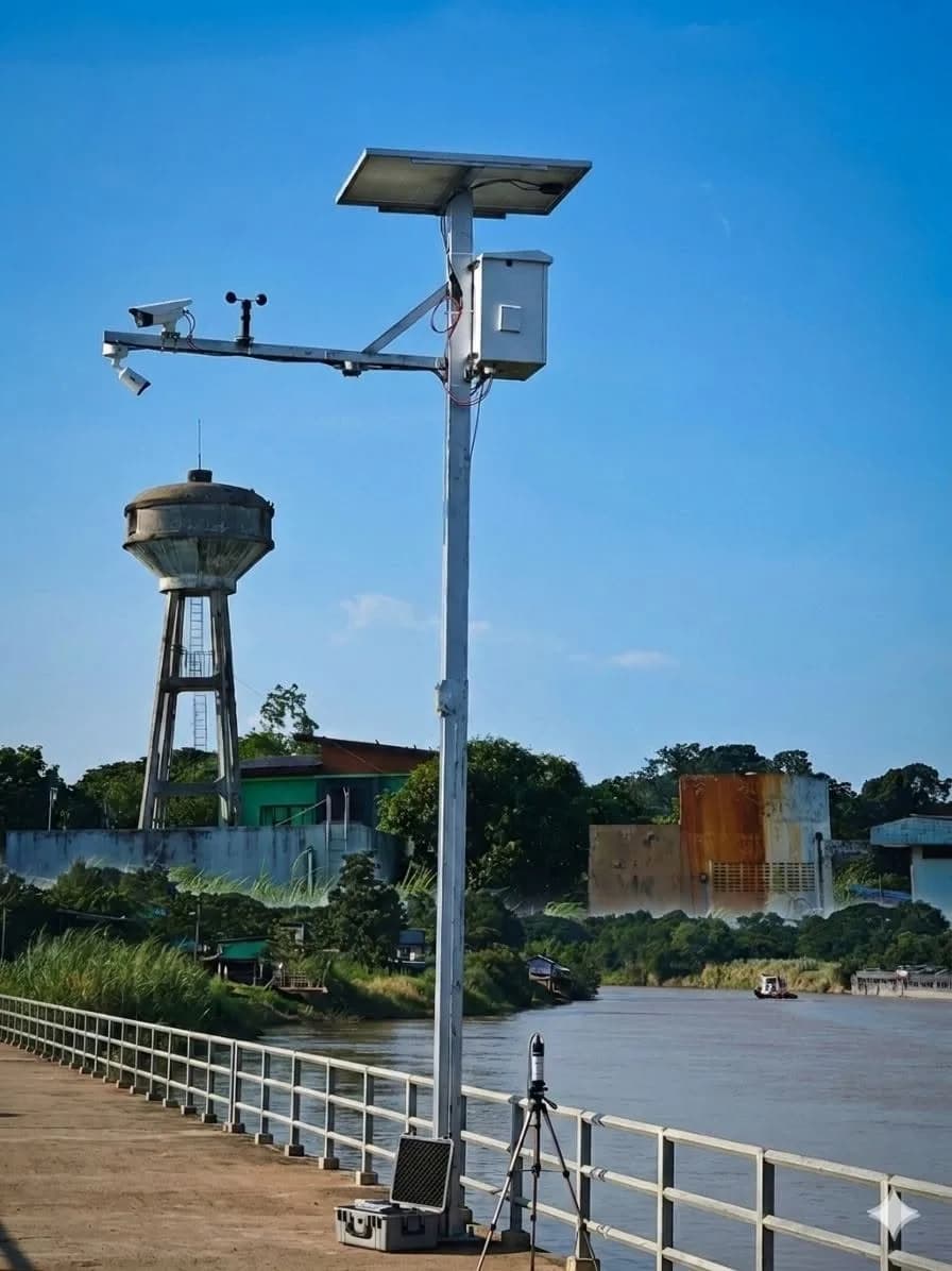
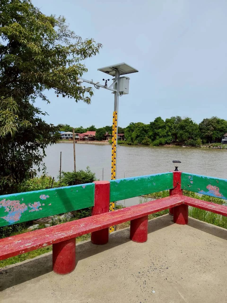
DoRare station installed along the reservoir

Which areas suit Modern Area, and how do you start?

Modern Area suits municipalities, local authorities, irrigation teams and area infrastructure integrators with multiple risk locations and too few staff to take daily field readings. It combines DoRare Station, a non-contact 80 GHz radar water-level station; DoRare View, which reads water levels from existing CCTV; and InSensor for field sensor data collection and processing. All stations appear on one map with threshold-based alerts.

There are 2 starting options. Use DoRare View with existing CCTV that clearly shows a staff gauge both day and night, from THB 5,500 per month. Alternatively, install a solar- and battery-powered DoRare Station, from THB 250,000 per station (including VAT). If existing cameras cannot see a staff gauge, start with DoRare Station.

The system supports measurement and alerts. Public warnings and local response decisions remain the responsibility of authorised officials. DoRare Station sends data over 4G mobile networks, so locations with weak or no signal are not ready for installation and require a site survey first.

Crisis Power Management: sensors can operate for 1 month without sunlight

Crisis energy-management mode maintains sensor measurements by adjusting operating intervals to the remaining energy

What should you clarify before installing water-level stations?

Answer the 4 questions below before installation. Your answers determine station count, locations and alert thresholds.

  • Which locations are most at risk?

    Before choosing station numbers, we start with locations where water rises quickly, past flood locations and routes used by residents.

  • How reliable are the station readings?

    Installation position, reference level and obstructions beneath the sensor affect readings. Initially, we compare measurements with the existing staff gauge before using them to set thresholds.

  • How can you tell in advance that water is nearing a threshold?

    Look at both current levels and historical records to see how quickly water rose during past rainy seasons, then use that information to set monitoring thresholds for each station.

  • What happens next when the system alerts?

    An alert system needs accountable roles. Before going live, we define notification recipients, out-of-hours responsibilities and the actions required at each level.

Select what to develop

DoRare Station + 80 GHz radar

DoRare Station is a non-contact radar water-level station powered by solar panels and batteries. A camera captures actual images for comparison with measured values, providing field data for tracking water levels and setting monitoring thresholds.

Explore solutions — DoRare Station + 80 GHz radar

Citywide DoRare Viewer

The DoRare dashboard is a web page that brings every station onto one map. Staff can view the latest water levels, camera images and historical readings to decide which locations need attention first.

Explore solutions — Citywide DoRare Viewer

InTown: Community Digital Twin

InTown places CCTV images alongside readings in a community Digital Twin, a digital representation of the area. Local administrators can see actual conditions while monitoring the situation. The scope is assessed against the data available in each community.

Explore solutions — InTown: Community Digital Twin

InSensor

InSensor collects sensor data, processes it on site and sends it to the central system. It contains the X1 Board together with the X1 Power, X1 Mainboard, X1 RS485-CAN and X1 Output modules.

Explore solutions — InSensor

From on-site data to decision-making

  1. Field locations

    Radar 80 GHz, DoRare Station or existing CCTV at surveyed risk locations.

  2. Processing and data integration

    InSensor and the systems specified for the project take readings, check device status and send data to the central system.

  3. Citywide overview

    The DoRare and InTown dashboards display data and send alerts to the designated responsible staff.

What we have learned from real work

The guidance below comes from our actual water-level station installations. Each point explains what we did, what we learned and what it means for your area.

Station readings must be verifiable against images

Our experienceIn 2026, we installed 20 DoRare Station units along rivers in 4 Thai provinces, with additional weather stations at 5 locations. Each cabinet has a camera that photographs a staff gauge for AI readings approximately every 15 minutes, plus a radar sensor for a separate water-level measurement.

What we learnedShowing the actual staff-gauge image beside its reading lets operators visually check that the displayed figure matches water conditions, and retain the image as supporting evidence.

What does it mean to you?Your stations should therefore have a way to cross-check readings from day one, such as a camera with a clear view of the staff gauge or an initial comparison with readings taken by staff.

Read the case study: 20 water-level stations across 4 provinces

Stations must also report their own condition

Our experienceIn the same project, every control cabinet runs on solar panels and batteries and sends data through a 4G router with a SIM card. The cabinet status page shows the battery, fan, router and SIM data usage, and operators can select from 4 power modes.

What we learnedField stations are remote and unattended. If the system cannot report a low battery or a lost connection, operators cannot tell whether missing readings are caused by water conditions or equipment. Power and communications planning is therefore part of the measurement system.

What does it mean to you?Before designing the system, we ask about mobile coverage and power sources at each location. Equipment alerts, such as an offline camera or low battery, are configured separately from water-level alerts.

See cabinet status monitoring in the 20-station water-level case study

Set thresholds and alert recipients for each station

Our experienceIn the same project, operators can set 3 levels—normal, watch and critical—for each station. When the critical threshold is reached, the system sends a LINE or email alert as configured.

What we learnedEach location has its own staff gauge and camera position. Scale calibration and alert thresholds must therefore be configured per station, rather than using one setting for the entire system.

What does it mean to you?Before launch, prepare a list of the roles that should receive alerts at each level and station, including those responsible outside office hours.

See alert threshold settings in the 20-station water-level case study


Select from the work you want to do

What type of work do you want to improve?

Select work to view related products and services, or search directly by known product name

Related products and platforms

SaaSAdaptable
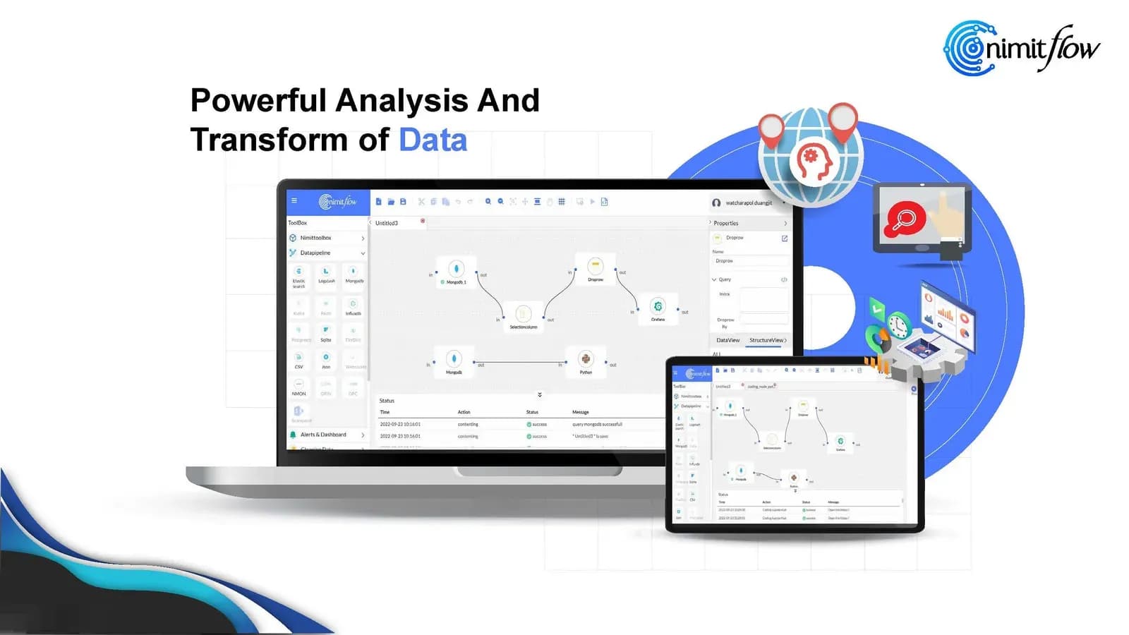
nimitFlow

nimitFlow

Low-Code platform for drag-and-drop creation of automated workflows and Data Pipelines, starting at THB 8,000/month

Collects data from DoRare stations, displays it as graphs, and alerts via LINE or email

Suitable for: IT teams and engineers who need to connect data from multiple systems and add Python code to suit their tasks

Details
Hardware
DoRare Station

DoRare Station

Water level radar station at 80 GHz and weather condition measurement, operates 24 hours with solar cells and backup battery according to station specifications

Suitable for: Organizations and teams that need to install new water and environmental monitoring stations

Details
SaaS
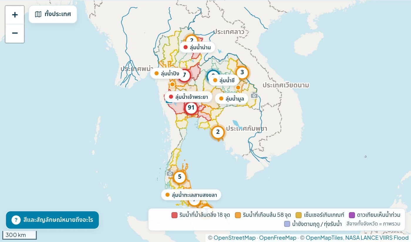
Thailand map with water level monitoring stations and data layers from DoRare-Viewer

DoRare-Viewer screenshot · Captured on 22 Oct 2569 B.E.

DoRare View

Web map for monitoring water situation, integrating water level stations, camera images, rainfall, and satellite data to view overall and explore specific areas of interest

  • View maps by watershed, region, province, and measurement points
  • Select water level, rainfall, cloud, satellite, and camera data layers
  • Data for tracking areas, monitor agency announcements concurrently

Suitable for: Organizations and area management teams that need to monitor water levels and camera images

Open DoRare-Viewer
Hardware
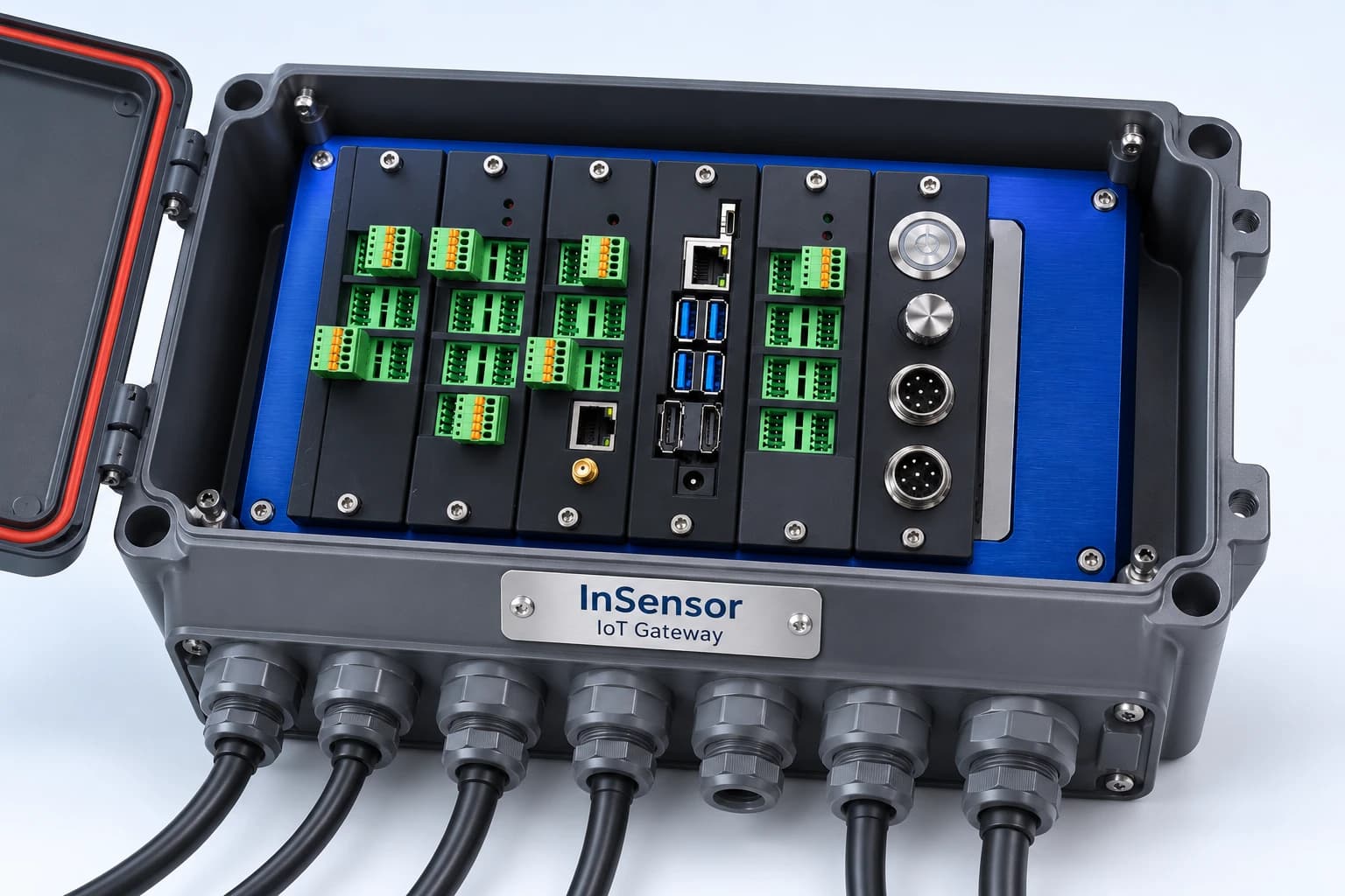
InSensor IoT Gateway mockup set in an industrial case

InSensor mockup set based on reference equipment image · Actual configuration depends on the selected set

InSensor

IoT Gateway set for receiving sensor and machine data, featuring X1 Board as controller, processing at edge then sending data via MQTT to central system

  • Configure board to receive analog, RS-485/Modbus, and digital I/O signals according to job requirements
  • Transmit data via Ethernet or external 4G router
  • Select board sets with cases and installation services at the point of use

Suitable for: Researchers, system developers, and system contractors who need to collect field sensor data

Details

Prepare data for discussion with engineers

  • Installation locations with coordinates, previously flooded sites and priority monitoring areas
  • Sample CCTV images, mobile coverage at installation locations and available power sources
  • Thresholds for each watch level and the roles responsible when an alert is raised
  • Time from reaching a water-level threshold to acknowledgement by the responsible person, for comparison before and after installation
Talk to our engineering team