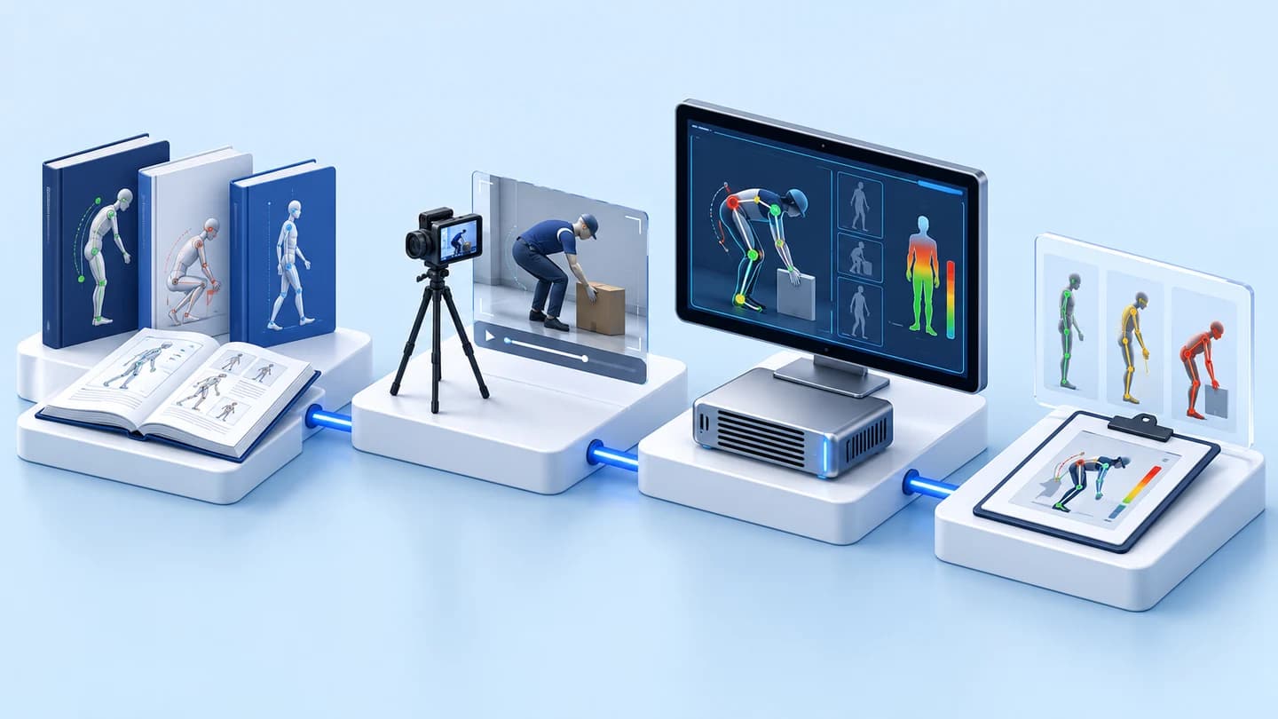





Prototype software decoding APT signals from the NOAA-18 weather satellite into images
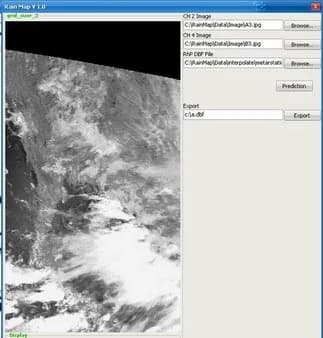
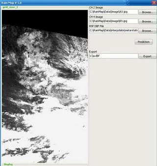
This prototype software decodes APT signals recorded as audio files from the NOAA-18 weather satellite in 2009 into satellite images. A separate image viewer imports CH2 and CH4 channel images, displays them alongside a map of Thailand and exports data as .dbf files.
- Industry
- Services
- Year
- 2009
- Scope of work
- 2-part prototype software — Decoding part: the input is an audio file of APT signals recorded from the NOAA-18 satellite in 2009 → signal decoding → satellite image · Image viewer part: import CH2 and CH4 channel images → display alongside a map of Thailand → export data as a .dbf file · Tools according to the project history: Matlab, C/C++ and MySQL · The system starts from signal files that have already been recorded; the antenna and signal receiver are out of scope
Summary
- This prototype software decodes APT signals recorded from the NOAA-18 satellite in 2009 into satellite images.
- The image viewer imports CH2 and CH4 channel images, displays them alongside a map of Thailand and exports data as a .dbf file.
- The input to the decoding part is an audio file that has already been recorded, so decoding can be repeated and checked against the same file without waiting for a satellite pass.
- The antenna, the receiver and the criteria for measuring image accuracy are outside the scope of this work. New work must design and test these parts at the actual installation site.
- The NOAA-18 satellite has been retired. New work must choose a satellite that is still transmitting.
The on-site brief
NOAA weather satellites send images down as APT (Automatic Picture Transmission) radio signals. Recording the signal produces an audio file, not an image that can be opened straight away, so software is needed to decode the signal into an image before it can be viewed or analysed further.
What we did
This prototype decodes APT signals recorded from the NOAA-18 satellite into images. A second part is an image viewer that imports CH2 and CH4 channel images, displays them alongside a map of Thailand and exports data as a .dbf file. The evidence for these 2 parts comes from separate sets of files, so we describe them as 2 separate parts.
Signal decoder
- Recorded APT signal file from NOAA-18
- Decode signals into images
Image viewer
- Import CH2 and CH4 channel images
- Display alongside a map of Thailand and export .dbf
Summary: 2 separately evidenced parts: signal-to-image decoding and image viewing with data export
Test results with real workpieces
The decoding part decodes APT signal files recorded from NOAA-18 into images, and the image viewer displays CH2 and CH4 channel images alongside a map of Thailand, with a command to export .dbf files. This result confirms the decoding of signals into images. Before any practical use, criteria for measuring image accuracy against reference data must first be set.
How the brief came about
The brief for this work was to turn radio signals from a weather satellite into images that can be opened and viewed. NOAA satellites send images down as APT signals while passing overhead. Recording this signal produces an audio file, not an image file.
What is APT?
APT (Automatic Picture Transmission) is the format in which NOAA weather satellites transmit images as radio signals. Recipients can record this signal as an audio file, and software must then decode it into an image before it can be used to view cloud conditions or for further analysis.
This work has 2 parts: a decoding part that works with signal files recorded from the NOAA-18 satellite in 2009, and an image viewer for CH2 and CH4 channel images alongside a map of Thailand.
Requirements and constraints
The requirements for each part were defined by its inputs and outputs, and the scope of the work is as follows.
- The input to the decoding part is an audio file of APT signals already recorded from the NOAA-18 satellite.
- The output of the decoding part is a satellite image.
- The inputs and outputs of the image viewer are CH2 and CH4 channel images, a map of Thailand and a .dbf file.
- Scope: the system starts from signal files that have already been recorded. The antenna and signal receiver are out of scope.
- Scope: we describe the decoding part and the image viewer part separately because the evidence for each comes from a separate set of files.
How does this prototype turn satellite signals into images?
This prototype takes an audio file of APT signals recorded from the NOAA-18 satellite and decodes the signal into an image. The image viewer imports CH2 and CH4 channel images, lets the user choose to view them alongside a map of Thailand, then exports data as a .dbf file for use in other programs.
- 1
Recorded signal files
APT signals from the NOAA-18 satellite are first recorded as an audio file, so decoding can be repeated on the same file.
- 2
Decode signals into images
Software decodes the signal in the audio file into a satellite image.
- 3
View images alongside the map
The image viewer imports CH2 and CH4 channel images and displays them alongside a map of Thailand.
- 4
Data export
The program exports data as a .dbf file, which is a tabular database file.
The image viewing and data export steps come from screenshots of the image viewer, while the recording and decoding steps come from the signal files and the decoding project history. All 4 steps are therefore a sequence of work, not a diagram of a single program.
System components
This prototype has 2 parts: the decoding part and the image viewer part. The table shows how each part works and the evidence for it.
Components and evidence for each part
| Prototype part | What it does | Evidence |
|---|---|---|
| Signal decoder | Decodes APT signals recorded from NOAA-18 into images | Signal files recorded in 2009 and a project history listing the tools Matlab, C/C++ and MySQL |
| Image viewer | Imports CH2 and CH4 channel images, displays them alongside a map of Thailand and exports .dbf files | Program screenshots showing channels CH2 and CH4, a map of Thailand and the .dbf file export command |
Test results with real signals
The decoding part decoded real APT signal files recorded from the NOAA-18 satellite in 2009 into images, and the image viewer displayed CH2 and CH4 channel images alongside a map of Thailand and could export .dbf files. This result confirms the decoding of signals into images. Image accuracy must be measured against reference data when the work is put to use.
- Signal used for testing: APT signal files recorded from the NOAA-18 satellite in 2009 could be decoded into satellite images.
- The image viewer screen shows CH2 and CH4 channel images imported and displayed alongside a map of Thailand, with a command to export .dbf files.
- Tools used according to the project history: Matlab, C/C++ and MySQL
What we learned
The main principle from this work is to separate signal reception from signal decoding and to record the evidence for each part separately. The principles below apply to satellite data reception work and to prototype work with multiple parts.
- Separate signal reception from signal decoding. When the signal is first recorded to a file, the team can develop and check the decoding software repeatedly against the same file, without waiting for a satellite pass each time.
- Do not tie the system to a single satellite. The NOAA-18 satellite has been retired, so the parts that depend on each individual satellite should be kept separate from the image display and data export parts, so that the signal source can be changed.
- A prototype with multiple parts must record evidence for each part separately: what each part does, what was tested and when it was done. In this work, the evidence for the 2 parts is in separate sets, so we have to describe them as 2 separate parts.
How this approach can apply to your work
If your work needs to turn recorded radio or satellite signals into images or data, you can use the same sequence as this work: record the signal, decode it, display the result alongside a map, then export the data. What must be designed in addition is signal reception and the image test criteria, because this work started from files that were already recorded.
Reusable parts and parts that need adapting
| Part of the work | Reusable | Needs adapting when |
|---|---|---|
| Signal decoding | The approach to decoding recorded files into images | The satellite you use transmits in a different format from APT; the signal format must be checked first |
| Signal input | Recording the signal to a file before decoding, so tests can be repeated | The antenna and receiver must be designed and tested at the actual installation site |
| Visualisation | Choosing to view each channel's image alongside the map | The area you are interested in is not Thailand; the map must be changed and you must check that the image lines up with it |
| Data export | Exporting to a tabular file for use in other programs | Your destination system accepts other formats, such as CSV or a database |
- Choose a satellite that is still transmitting and check which signal format it uses.
- Record several sets of real signal files from your area for repeated software testing.
- Agree on the image test criteria before starting, for example what a usable image must look like and which reference data it will be compared with.
Images of the system and how it works
Technology used
Frequently Asked Questions
Why record the signal to a file before decoding it into an image?
Because once the APT signal is recorded as an audio file, the development team can decode the signal and check the software repeatedly against the same file, without waiting for a satellite pass each time. In this work, the input was a file recorded from NOAA-18 in 2009.
Can this prototype receive signals from a satellite by itself?
This work starts from signal files that have already been recorded. The antenna and signal receiver are out of scope. If your work needs to receive signals itself, the reception part must be designed and tested at the actual installation site.
Can this be used with the NOAA-18 satellite today?
No. The NOAA-18 satellite has been retired. New work must choose a satellite that is still transmitting and check whether it uses the same signal format as APT.
Can data from the image viewer be used further in other programs?
Yes, in .dbf file format. The program screenshot shows a command to export data as a .dbf file, which is a tabular database file. If your system uses another format, the export file format must be defined anew.
If the area of interest is not Thailand, what needs to be adjusted?
The map in the image viewer part must be changed, and you must check that the image lines up with the map. The decoding can use the same approach if your satellite transmits APT signals.